History of Fort Hill, Part 2 (2008). Mural by: Loray McDuffie, Taylor Saintable, Edwin Perez-Clancy, Christine O'Connell, Julia Andreasson, Jorge Benitez, Divah Payne, Lucy Saintcyr, Laua Dedonato, Gregg Bernstein.
Showing posts with label MBTA commuting walking bicycling. Show all posts

Tuesday, September 28, 2010

Destinations off the hill: the walking route to Kenmore

Edward M. Kennedy's funeral mass was said 29 August at the Mission Church. In many ways this minor basilica is a much more impressive building from the back than it is from the front.

In an earlier post we sung the praises of Fort Hill's location, briefly listing some of its nearby cultural, educational, and transportation options. Still speaking from the stance of a Fort Hill booster, this post will take a more practical slant and try to take a liability—poor transit options on the NNW to NW of Roxbury Crossing—and turn it into a benefit.

For the most part, the transit options from Fort Hill are particularly fine and varied. The Orange line is excellent for those going NE to the city center or SW to Jamaica Plain. The 19, 22, 23, and 28 buses serve reasonably well for those going S and SE to Dorchester. The 15 and 41 do a decent job when heading due E. At the best times of day the 66 is tolerable going W into Brookline.

But, the MBTA has nothing quick when one is heading N or NNW to the Longwood Medical Area, to the Gardner Museum, to MFA, to the Fens, or to Kenmore.

It is in this direction that the old libel against the T is so true: Should we walk? Or, do we have time to take the T?

When headed NNW, it is always best to walk or to bicycle. And, walking works just fine. Early last week (perhaps on the same day Iseut was collecting an oral history on the Mission Church Grammar School) we headed out to the Kenmore office of Harvard Vanguard Medical Associates. (Via the MBTA, we would have to take the 66 bus and change to the 65. Or, schlep in on the Orange Line, doing a walking transfer at Back Bay-Copley to head back out to Kenmore.)

Here is the route we took:
  • Tremont to Gurney, cut through the vacant lot to Smith, Smith to St. Alphonsus to Huntington.
  • Take the unregulated crosswalk just inbound from Ward Street to avoid waiting at the dangerous light at Longwood.
  • Then head inbound on Huntington to Evans Way and cut through the park to The Fenway.
  • Take either crosswalk over The Fenway (in front the Gardner Museum or further up in front of Simmons) and descend to the level of the Muddy River (see the great field of daffodils in the springtime).
  • Rise up from the river at Park Drive, taking your life into your hands at the crosswalks there.
  • Pass through the Field of Geese under which the Muddy River is buried.
  • Cross over to the north side of Park Drive at the crosswalk.
  • Then it's a straight shot through the snarling intersection at Boylston and up Brookline to Harvard Vanguard.
With one twiddle, Google figures it to be 28 minutes; we walked it in 20 with five minutes to cool down. (Google wants you to take Parker Street to Ruggles, when the back way up Smith Street is a much nicer walk.)

Walking this route is not only a practical mode to reach an appointment in Kenmore, but it is also an interesting walk. Here is a handful of briefly annotated photographs depicting what can be seen along this route as far as Isabella Gardner's unfortunate backyard.

The Maurice J. Tobin School is easy to miss, hidden behind the shade trees on Smith Street. This mural is seen from the playing fields on the east side of the school.


Not the best looking side of St. Alphonus Hall, as seen from the same playing field. At least it's been properly boarded up with plywood painted to match the stone. The worthies at RCC should take notice.

One hopes that this sign can be preserved. As few as five years ago, the internet was bereft of any hits for Pilate's Daughter; it was all Pilates all the time. Now Google yields a fair amount of notice for the search string. Perhaps John Clifford could tell us something from a first-hand perspective.

Every spring, the management company at Mission Main plants what becomes a tsunami of impatiens by season's end. The begonias don't do too badly either.

Devotion to Our Lady is laudably strong on Smith Street, with at least three effigies—but no blue bathtubs. The less laudable inflatable pumpkins, reindeer, and Santa Clauses are due to erupt anytime now. Chacun à son goût.
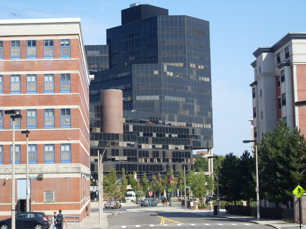
A view of the "new", formerly infamous Boston State College building viewed from St. Alphonsus Street. A middling building of its kind, we're hoping that auditorium is working out for MassArt, it's current occupants.


The former site of a grifty little gas station at the corner of Ward and St. Alphonsus streets, this park is a great improvement.

It's a shame about Isabella's carriage house, but we're hoping the trustees have made the right bet.

Tuesday, September 7, 2010

Darryl Settles's Corner Bar & Kitchen finds a landing pad

Darryl Settles's latest venture, Darryl's Corner Bar & Kitchen, has opened on the border between Lower Roxbury and the South End. This is the location of the long-time Boston landmark restaurant, Bob the Chef's, and, most recently, of the Stork Club.

Here is how Mr. Settles describes the core concept behind his establishment: "When we first started working on the Darryl’s Corner Bar & Kitchen concept we knew we wanted to be a Great Bar with a great kitchen as opposed to a Great Restaurant with a great bar. The distinction is important."

In anchoring his establishment around a bar, rather than a restaurant, Mr. Settles asserts that the "Corner Bar has always been an important part of our community, whether as a meeting place for revolutionaries or respite for the working man."

With the gentrification of the South End and Northeastern's salient into Lower Roxbury, it seems revolutionaries are scarce on the ground. (Lucy Parsons, anyone?) With the unemployment rate nearing Great Depression levels in Roxbury, the class of working men and women is getting much smaller, too. Perhaps students and the white collar class will make up for the missing proletariat and revolutionaries.

Despite the conceptual emphasis on the drinks, Darryl's Corner Bar & Kitchen does not neglect the kitchen. Here is a three-page pdf of the menu (sans prices).

Mr. Settles has been working his publicity machinery well. A google search for the bar's name yields a solid 50 hits of press announcements and reviews. The Bay State Banner has published a feature article.

That corner of Columbus Avenue and Northampton Street ("the intersection of friends, food, and music") is a quick 7 minute bicycle ride and a brisk 20 minute walk from Mr. Settles's first choice of location for his bar and restaurant, so residents of Fort Hill have yet another convenient choice for drinks and dinner.

A little more than six months ago, Mr. Settles investigated 85 Centre Street on Fort Hill as a possible location for his bar and restaurant.

Iseut via UniversalHub brought Mr. Settles's Fort Hill designs to our attention, providing the impetus for this blog. The first twelve posts conclude with this coda. Those posts chronicle some of the kerfuffle Mr. Settles's proposal provoked on the Centre Street side of Fort Hill. It is bizarre that these posts, from a infant blog with a grand total of 40 posts, aspiring only to cover a tiny part of a middling city, consistently show up high on the first page of a google search on the words Darryl Settles.

Despite our previous opposition, we are very pleased that Mr. Settles's has found a congenial location for his bar and restaurant. We are sorry that some on Fort Hill were disappointed that that location was not at 85 Centre Street. But, we are confident that Darryl's Corner Bar & Kitchen will flourish "at the intersection of food, friends, and music." (So far, the church at 85 Centre Street has remained a reasonably quiet and considerate neighbor.)

The timing of the opening of Darryl's Corner Bar is auspicious for the jazz festival that Mr. Settles founded ten years ago, The Berklee Beantown Jazz Festival, is set to start next week on 15 September and is to run for the next ten days.

The festival is located on Columbus Avenue between Burke Street and Massachusetts Avenue, right on the front steps of Darryl's Corner Bar. [This image is owned by the Berklee College of Music.]

Monday, April 5, 2010

Urban Amenities: Location, location, location

From this prospect behind the Dillaway-Thomas House at the Roxbury Heritage State Park the view encompasses from Back Bay to South Station.

While not perhaps an amenity, per se, Fort Hill's location must be one of its single greatest assets.

Central to the City of Boston, Fort Hill is within easy striking of the entire city, whether on foot, by bicycle, or by mass transit. It is even convenient to drive, if you know the secret parking places closer into the city center.

Walking or bicycling inbound, the Southwest Corridor Park is a green slice through Roxbury and the South End directly into the city. Going southwest, the Corridor leads all the way to the Arboretum.

The Boston Museum of Fine Art, the Gardner Museum, the Fenway and Muddy River, Symphony Hall are all easy bicycling and walking destinations on a bright spring day. Even closer are Malcolm X and Harris Park and the National Center of Afro-American Artists.

These schools are all within walking distance: Northeastern University, Simmons College, Wentworth Institute of Technology, Massachusetts College of Art, Harvard Medical School, Harvard School of Public Health, Massachusetts School of Pharmacy, Emmanuel College, and Wheelock College. (What have I left out?)

Slightly farther away are the the Back Bay and the Charles River Esplanade. In the other direction, Leverett Pond, Jamaica Pond, and the Arboretum are all within easy bicycling and walking distance. Franklin Park and the Franklin Park Zoo are a short distance down Seaver Street.

Even if these destinations seem a little far to walk for our tender American feet, Fort Hill is served by over 40 bus stops, 2 rapid transit stops, and 21 different bus lines.

For those of us who only think in an automotive mode, Fort Hill is close to Storrow Drive, the Mass Pike, and the Southeast Expressway. Route 9 leads the way west to Newton and 128. This means that employment flexibility is maximized as measured by commuting time. In addition to the center city, Andover, Braintree, Waltham, Cambridge, Burlington, and Lexington, are all feasible commutes by car. They have the additional benefit of being reverse commutes, as well.

The next posts will examine the wealth of MBTA options that runs through and adjacent to Fort Hill.