History of Fort Hill, Part 2 (2008). Mural by: Loray McDuffie, Taylor Saintable, Edwin Perez-Clancy, Christine O'Connell, Julia Andreasson, Jorge Benitez, Divah Payne, Lucy Saintcyr, Laua Dedonato, Gregg Bernstein.

Tuesday, September 28, 2010

Destinations off the hill: the walking route to Kenmore

Edward M. Kennedy's funeral mass was said 29 August at the Mission Church. In many ways this minor basilica is a much more impressive building from the back than it is from the front.

In an earlier post we sung the praises of Fort Hill's location, briefly listing some of its nearby cultural, educational, and transportation options. Still speaking from the stance of a Fort Hill booster, this post will take a more practical slant and try to take a liability—poor transit options on the NNW to NW of Roxbury Crossing—and turn it into a benefit.

For the most part, the transit options from Fort Hill are particularly fine and varied. The Orange line is excellent for those going NE to the city center or SW to Jamaica Plain. The 19, 22, 23, and 28 buses serve reasonably well for those going S and SE to Dorchester. The 15 and 41 do a decent job when heading due E. At the best times of day the 66 is tolerable going W into Brookline.

But, the MBTA has nothing quick when one is heading N or NNW to the Longwood Medical Area, to the Gardner Museum, to MFA, to the Fens, or to Kenmore.

It is in this direction that the old libel against the T is so true: Should we walk? Or, do we have time to take the T?

When headed NNW, it is always best to walk or to bicycle. And, walking works just fine. Early last week (perhaps on the same day Iseut was collecting an oral history on the Mission Church Grammar School) we headed out to the Kenmore office of Harvard Vanguard Medical Associates. (Via the MBTA, we would have to take the 66 bus and change to the 65. Or, schlep in on the Orange Line, doing a walking transfer at Back Bay-Copley to head back out to Kenmore.)

Here is the route we took:
  • Tremont to Gurney, cut through the vacant lot to Smith, Smith to St. Alphonsus to Huntington.
  • Take the unregulated crosswalk just inbound from Ward Street to avoid waiting at the dangerous light at Longwood.
  • Then head inbound on Huntington to Evans Way and cut through the park to The Fenway.
  • Take either crosswalk over The Fenway (in front the Gardner Museum or further up in front of Simmons) and descend to the level of the Muddy River (see the great field of daffodils in the springtime).
  • Rise up from the river at Park Drive, taking your life into your hands at the crosswalks there.
  • Pass through the Field of Geese under which the Muddy River is buried.
  • Cross over to the north side of Park Drive at the crosswalk.
  • Then it's a straight shot through the snarling intersection at Boylston and up Brookline to Harvard Vanguard.
With one twiddle, Google figures it to be 28 minutes; we walked it in 20 with five minutes to cool down. (Google wants you to take Parker Street to Ruggles, when the back way up Smith Street is a much nicer walk.)

Walking this route is not only a practical mode to reach an appointment in Kenmore, but it is also an interesting walk. Here is a handful of briefly annotated photographs depicting what can be seen along this route as far as Isabella Gardner's unfortunate backyard.

The Maurice J. Tobin School is easy to miss, hidden behind the shade trees on Smith Street. This mural is seen from the playing fields on the east side of the school.


Not the best looking side of St. Alphonus Hall, as seen from the same playing field. At least it's been properly boarded up with plywood painted to match the stone. The worthies at RCC should take notice.

One hopes that this sign can be preserved. As few as five years ago, the internet was bereft of any hits for Pilate's Daughter; it was all Pilates all the time. Now Google yields a fair amount of notice for the search string. Perhaps John Clifford could tell us something from a first-hand perspective.

Every spring, the management company at Mission Main plants what becomes a tsunami of impatiens by season's end. The begonias don't do too badly either.

Devotion to Our Lady is laudably strong on Smith Street, with at least three effigies—but no blue bathtubs. The less laudable inflatable pumpkins, reindeer, and Santa Clauses are due to erupt anytime now. Chacun à son goût.

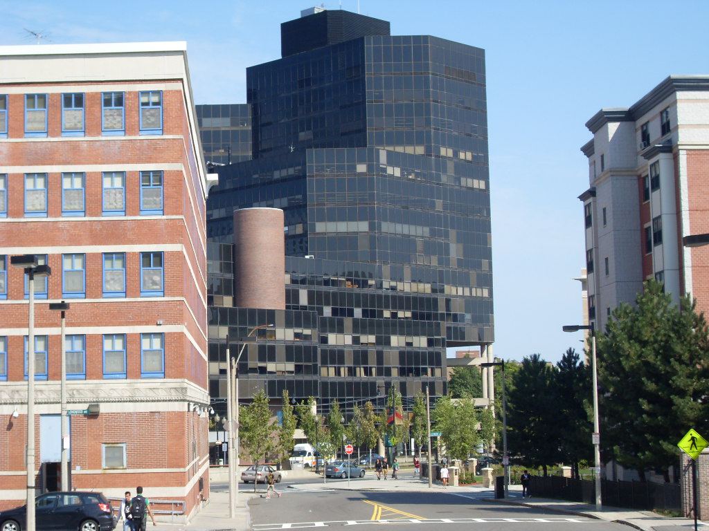
A view of the "new", formerly infamous Boston State College building viewed from St. Alphonsus Street. A middling building of its kind, we're hoping that auditorium is working out for MassArt, it's current occupants.


The former site of a grifty little gas station at the corner of Ward and St. Alphonsus streets, this park is a great improvement.

It's a shame about Isabella's carriage house, but we're hoping the trustees have made the right bet.

Monday, September 27, 2010

Rush Hour Bicycle Census at Columbus & Cedar

1885 Ordinary, with the small wheel in front.  From Patent Pending Blog.
We performed another bicycle census at the intersection of Columbus Avenue and Cedar Street this past Thursday, 23 September 2010 between 5 and 6 pm.  The temperature was in the high 60s, the wind was calm, and the skies were clear.  We posted ourselves on the outbound side of Columbus Avenue just north of Cedar Street.

Our previous census was done on 3 June 2010 from 5:18 to 5:40 pm. We counted on our fingers while waiting for a #22 bus to show up.  We counted 103 bicyclists. This was done over a 22-1/2 minute period, yielding an hourly rate of 275 bicycles/hour.

This time, equipped with paper and pencil, we performed a more deliberate census making tallies for each five-minute interval between 5 and 6 pm.  For both the inbound and outbound directions we counted helmeted and unhelmeted bicyclists, walkers, and runners.

Surprising to us, the hourly rate was  213, a 22% drop from the 3 June count.  Put another way, in the 25 minute interval between 5:15 and 5:40—approximately the same time period of the June count—there were only 95 bicycles compared with 103 in 22-1/2 minutes.

One oughtn't generalize from only two counts, but we would have thought that with the students back in town there would have been more bicyclists, not fewer.

Here is a summary of the results for bicycles:

BicyclesHelmetedUnhelmetedTotal
Inbound152641
Outbound13240172
Total14766213

And for Pedestrians:

PedestriansWalkersRunnersTotal
Inbound17219
Outbound23326
Total40545

The split between helmeted and unhelmeted bicyclists was 70:30, far different to my guesstimate on 3 June of 95:5.  The split between outbound and inbound bicycle traffic was 81:19, remarkably close to my guesstimate in June.

Another observation is that the unhelmeted inbound riders—going against the homeward commute—exceeded the number of helmeted riders, while outbound the helmeted riders outnumbered the unhelmeted ones by a greater than a 3-to-1 margin.

There was one recumbent bicycle (outbound) and one bicycle rigged for freight (inbound) with an extended frame in the rear.  There were two outbound scooters not included in the count.  The were only two bicyclists traveling in Columbus Avenue proper; they were both inbound and were included in the count.

Bell Biker Bicycle Helmet.  Photo by Melissa Lew from America On the Move.

Saturday, September 25, 2010

Feeling stimulated? Some of ARRA's $787B comes your way

First it was Talbot Avenue, crosswalks, bike lanes, parking strips, and 'adjusting' the Codman Square traffic flow.  Very nice.

Then it was Blue Hill Avenue, done at the beginning of rush hour, that made Morton Street/Rt. 203 an attractive alternate route.  Didn't MLKing Blvd get redone, too?

Now tonight it sounds like Marine One is hovering low, in front of Roxbury Community College.  Our stimulus dollars have arrived circa your house.

The spreader machine with its dump truck tender is surprisingly quiet.  It's the growler in the picture on the bottom (and its mate) that make all the low rumbling noise.

The politicians want you to know that all that American Recovery and Reinvestment Act dough is well spent.  Here's what the Feds have to say.  This is the Commonwealth's take on things.  The City of Boston provides its accounting here.


Friday, September 24, 2010

Moving on: A wistful farewell to the Third Decade

This delightful photograph is from an occasional series TD ran depicting various attempts of too-large-vehicles to slalom down his too-small street.

The Third Decade announced back in June that he was ending his six-year-long affair with blogging and will continue canoodling exclusively with Twitter and Facebook.

More's the pity.

From C'mon, Bush, Talk to the Colored Folk and the continuing saga of Homeownership in 2004 to Boloco and From Filenes to Ferdinand in 2010, it was a good run. And in between, he was eying the cute guys on the Orange Line and sharing ruminations on how the city worked—and didn't work.

We keep checking the blog, hoping TD will change his mind, but that seems not to be in the cards.

It's too bad that TD changed the blog layout with the last post. The elegantly narrow, black and white streetscape is gone, replaced with a vapid green layout. (On what other local blog have we seen that theme?)

Moreover, with the hasty change in layout, the navigation has been broken so that one has to twiddle with the url to get early pages.

And he can't count very well, for his 30s were his fourth decade, not his third.

Sigh. We sound jilted, don't we? Abandoned for the ephemera of tweets and feeds, where it's hard to discriminate between noise and signal.

Third Decade, we'll miss you.

Thursday, September 23, 2010

Why we can't have nice things

Here are some of the handsome murals on the pillars at the Roxbury Crossing T stop.

Our favorite one is on the far left. We love the fanciful combination of the Chinese gate framing the mosque's minaret. The colors are dark and rich.

Its mate, on the right, frames the Mission Church's towers in a vaguely Moorish gate. It uses a lighter palette of blue and pink.

We thought they were a sensitive addition of public art to the second-rate design of that train station.

A vandal seemed to think otherwise. He seemed to think that his personal graffito would improve things.

Our mothers might say: This is why we can't have nice things!

Wednesday, September 22, 2010

Is it Fort Hill? Or, Highland Park? Perhaps it is the Roxbury Highlands?

This nice map appeared on eeka's blog last year. Quibbling, we would rope in the triangular Veteran's Park at the northeast corner. That yields only five long boundary streets, without that short pesky stretch of Shawmut.

Jonas Prang's focus is on the area of Roxbury bounded by Malcolm X Boulevard, Washington Street, Marcella Street, Ritchie Street, and Columbus Avenue.

Some folk seem to get agitated when the supposedly down-market moniker "Fort Hill" is used instead of the leafy appellation "Highland Park." The exalted epithet "Roxbury Highlands" has some adherents, too.

We think that any of the three names works just fine. And, work they do in different contexts.

Google Maps labels the area Highland Park, unless one zooms in too close.

Drop "Roxbury Highlands" Boston into maps.google and get this.

Do the same with "Fort Hill" Boston and get some other Fort Hill located in Hingham.

The neighborhood organizations seem to split the difference between Hill and Park. So a web site entitled "Highland Park Neighborhood" gives the "Fort Hill Civic Association" as the neighborhood's de facto town meeting, while also listing meeting times for the "Highland Park Neighborhood Assn."

Then, the on-again-off-again Our Highland describes itself as a" one-stop website for everything Highland Park, Roxbury."

For another example, in helping some folk to find housing in Greater Boston, we've been cruising through the Craigslist listings.

At the time we did our search, in boston/cambridge/brookline > housing > apts by owner, there were no apartments in "Highland Park," nor were there any in "Roxbury Highlands."

One is a little luckier with "Fort Hill." There were nine listings.

Alas, of these only five are unique, and only three of these are actually listed by the owner. The four other listings are broker-generated for the same, apparently haplessly unrentable, apartment.

Does this make "Fort Hill" more exclusive than "Mission Hill" with its 23 listings?


[An addendum: Iseut addressed the issue of names for Fort Hill in a post in March. A few other folk weighed in with comments, some more helpful than others.]

Tuesday, September 21, 2010

Youth Resources for Greater Dudley

While rummaging around the internet, we turned up this document, published just last month, Neighborhood Briefing Document: Greater Dudley [2.5MB pdf]. It is published as Issue 58, August 2010, of the Emmanuel Research Review.

From the table of contents page:

"The Greater Dudley Neighborhood Briefing Document was researched and written by Rudy Mitchell for the Youth Violence Prevention Funder Learning Collaborative, with funding provided by the State Street Foundation. Design by Grace Lee. Layout by Steve Daman."

The work is copyrighted, 2010, by the Youth Violence Systems Project, and performed under the aegis of the Urban Ministry Resources of the Emmanuel Gospel Center.

Running to 64 pages, the paper is a background document intended for "urban pastors, leaders, and community members in their efforts to serve their communities effectively" [cite]. It provides a twelve-page history of Roxbury, from the birth of John Craft in 1630 to the Roxbury Strategic Master Plan (2004) [21MB pdf from the BRA].

For the document's purpose, the author clips Roxbury Highlands in half, including only the census tracts north of Cedar Street in the Greater Dudley study area (pdf page 17), though on the east side of Washington Street, Greater Dudley stretches beyond Malcolm X Park to Elmore Street.

The study details characteristics of the population (trends and ethnic/racial composition using Roxbury data as a whole; age, language, family structure, and economics and income from US Census tract data) and housing (owner-occupancy, also from Census data).

Then community institutions are enumerated and youth-oriented programs briefly described: the 42 Churches and Religious Institutions, plus the three convents and two mosques, the twelve schools (plus Gordon-Conwell's Center for Urban Ministerial Education, Northeastern University, and Roxbury Community College, and mistakenly mapping the Timilty School in Dudley Square in addition to its actual location in Eliot Square), the 29 Community Organizations and Programs, and the five Neighborhood Organizations.

Some Boston Police Department Youth Crime Statistics (2008) are given, concluding with a brief survey of Community Newspapers and Media and a two-page bibliography. Together with the newspapers and radio station, Both Ends of Dudley and Jonas Prang are the only two blogs listed.

Other Boston neighborhood studies for Uphams Corner, Bowdoin/Geneva, Grove Hall, South End/Lower Roxbury, and Morton/Norfolk are available at the EGC web site.

The first photograph, perhaps it aptly could be titled "The Three Young Men," was taken by Chase Grogan, Roxbury Presbyterian Church. The second, taken from page 4 of the Briefing Document, is an original oil painting by John Ritto Penniman (c. 1782-1841) of Meetinghouse Hill, Roxbury, Massachusetts, 1799. Art Institute of Chicago.